
As we increased in number, so we needed to move cafes and it was this which led to map, inspired by my love of bus maps and the fact that growing up in Wembley, the first map I learned to read was the London Transport Underground map.

It quickly morphed into a class flyer...

I left the class at the end of 2013 because Susan and I had decided them time had come for us to downsize from our large Victorian-semi in Lenton to something smaller in Chilwell or Beeston. I then changed the orientation of the map for another leaflet.

I then created an extended version of the map...

...and another.

There was no master plan or vision. I just kept tweeking the map. The next extension was the inclusion of Chilwell's Creative Corner at the High Road's junction with Cator Lane after I met Gary and Gail, the owners.
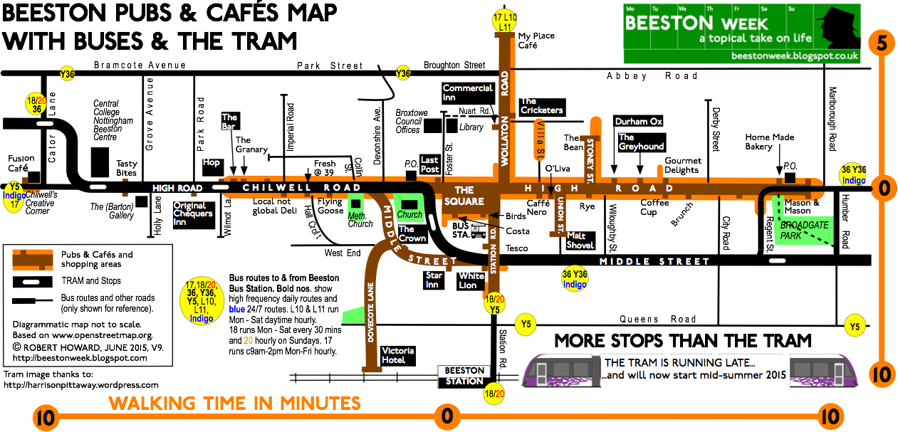
By now I was on a 9th version of the map and wanted to pull Beeston Lock onto the map so I could draw attention to the Beeston Canalside Heritage Centre project (which, at this point, still had to receive 2nd stage Lottery funding). Matt Turpin of The Beestonian also spoke about pulling the University into Beeston and Judy Sleath, the Chairman of Beeston Civic Society asked me if I could include blue plaque locations, so another, large version of the map came into being. It went from A4 to A3 and Judy funded the printing of 500 copies.

A 2015 Heritage Open Days version followed with Judy printing another 500 a month before the HODs.

A number of versions of this layout have subsequently been produced, but I always had in my head to create a vertical version because it would be easier to read and adapt, which is how a few months ago I arrived at this...

It hasn't taken me long to adapt this version, so that I could extend the map in the top left-hand corner...

As anyone who looks at this blog regularly will know I have created three versions of this map: the 'master' aimed at students, a 'heritage' version and a 'Beeston Nights' version, all of which can be found in the right-hand column. It has taken me three-and-a-half years to get this far and I have enjoyed creating the maps. Looking back, it is something I have been doing all my life, with my first map being published in 1976. Somewhere I have a copy.
All the maps have reverse text sides, the A3 ones with a Beeston Bus Map showing all the places you can reach by bus from Beeston (over a hundred). Again, you can find the latest version of the bus map in the right-hand column.
Anyway, that's it for now, all prompted by finding my very first Beeston Underground style map (which I had filed away on my computer in a directory labelled Beeston Writers).
No comments:
Post a Comment